此《北平风俗地图》由美国人Frank Dorn(美军驻华军事顾问团准将)绘制,北洋报业公司印行,《A Map and History of Peiping, By Frank Dorn》。
作者用漫画笔触描绘人物、动物、建筑、交通工具,惟妙惟肖地展现了民国年间北平城的风物民情,诸如老先生在西城斗鸡放鸽,小偷在晓市兜售珠宝项链,驼队和驴车进出左安门、右安门,外国人在西山打高尔夫。
以下为部分原文及译文
PEIPING HISTORICAL SKETCH.
The frst historical record of a city in the vicinityof the present site of Peiping is that which mentionsthe City of Chi in 1121 BC. It was destroyed by theEmperor, Ch'in Shih Huang Ti, in 221 BC. Duringthe Han Dynasty(206 BC-220 AD) a town was builtto the south of the site of Chi, but it remained a placeof little importance. After a long period of politicalupheaval in China, during which the site was ravagedseveral times,the Tang Emperors(618-906AD)rebuilt and named the city Yu-chou, making it theseat of a Governor-General. The Liaos, or KhitanTartars, destroyed this town in 986 and built a largercity which they first called Nan Ching, and then YenChing. The Chins,or NÃchen Tartars,in turn over-threw the Liaos, enlarged the old city, and called itChung Tu. In 1215 the armies of Genghis Khan captured the city, destroyed it, and slaughtered the inhabitants. Later Kublai Khan built a new capitaljust north of the site of Chung Tu(1264-1267)andnamed it Ta Tu,or Khanbalig,or Cambaluc. Thiswas the city which Marco Polo visited in the 13thCentury. In 1368 the Mings drove out the degenerateMongols and moved their capital to Nanking, renam-ing renam-ing Ta Tu,Pei P'ing(the present name).
北平历史速写。
北平现址附近的第一个城市历史记录是公元前1121年提到的池城。公元前221年,秦始皇将其摧毁。在汉代(公元前206年-公元220年),池遗址以南建了一座城镇,但它仍然是一个不重要的地方。在中国经历了长期的政治动乱,在此期间,该遗址多次遭到破坏,唐朝皇帝(公元618-906年)重建了这座城市,并将其命名为禹州,使其成为总督。公元986年,辽国或契丹鞑靼人摧毁了这座城镇,建立了一个他们最初称之为南京的大城市,然后又称为燕京。中国鞑靼人反过来推翻了辽国,扩建了古城,并将其命名为中土。1215年,成吉思汗的军队占领了这座城市,摧毁了它,屠杀了居民。后来忽必烈汗在中都(1264-1267)遗址以北建造了一座新首都,并将其命名为塔图,或康巴烈,或坎巴鲁克。这是马可波罗在13世纪访问的城市。1368年,明朝驱逐了沦陷的蒙古,并将首都迁至南京,更名为北平。
地图:
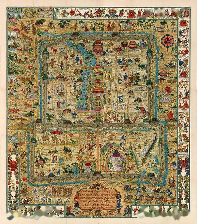
1936年《北平风俗地图》全图
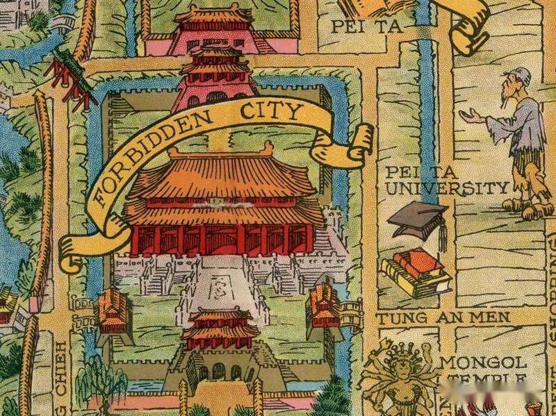
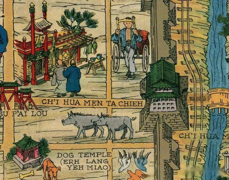
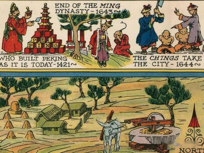
地图局部细节